Bear Box at Tyndall Creek at John Muir Trail (TC01)
Generated on 20 Oct 2025 - see revision history - please send updates to the webmaster
Detail Map of waypoint TC01
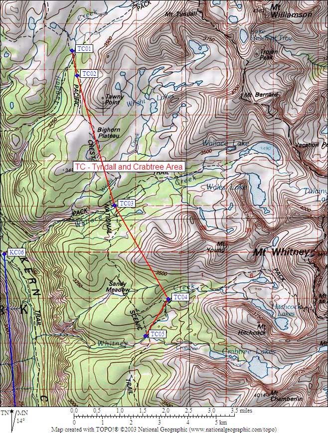
in Tyndall and Crabtree Area:
(scroll down for directions, waypoints, and area map)
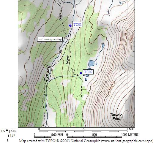
- TC01 is a standard box, at about 10900 feet,
in the GPS route TYNDALL CRABTREE.
- Directions from Kit Groves, with GPS waypoint, July 2000:
One box west of the trail and 100 yards north of the Tyndall Creek crossing.
It appears the trail in this area is shown incorrectly on the topo. The
box is at the coordinate given, but the trail is to the east of the box and
closer to the creek than is shown on the USGS maps.
- Directions from Mineral King ranger info sheet, dated 1991:
One box west of the John Muir Trail and about
350 feet north of the Tyndall Creek crossing.
- TC01 coordinates: (see GPX waypoint download links above)
  (lat,lon) = (36.6430200, -118.3874800) in decimal degrees, NAD83.
  (zone,east,north) = (11S, 376047.0, 4055973.0) in decimal meters, NAD27.
- Scroll down for a regional map of the entire Tyndall and Crabtree Area region.
Map exported from TOPO! software, used with permission.
Useful Links: