Bear Box at Junction Meadow Kern River (KC06)
Generated on 2 Aug 2022 - see revision history - please send updates to the webmaster
Detail Map of waypoint KC06
in Kern Canyon:
(scroll down for directions, waypoints, and area map)
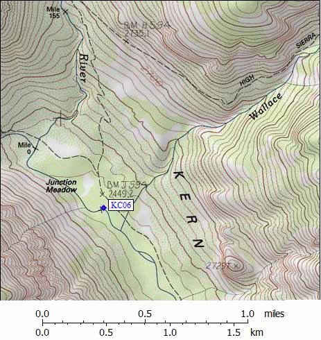
- KC06 is a standard box, at about 8100 feet,
in the GPS route KERN CANYON.
- Directions from M F Miller, Sep 2020:
Large brown bear box directly on trail
- Directions from Jeffrey Zimmerman, with revised GPS waypoint, Sep 2007:
It appears that the bear box at Junction Meadow in upper Kern Canyon
has been moved from the northern (upper) campground to the lower.
The coordinates previously posted clearly belong at the upper campground
yet the box is very obvious right beside the trail (5' away) at the lower
campground as of 2007. The lower campground has three campsites, the
upper has but one. The box bears a strict admonishment from the ranger to
build fires only in the prepared fire rings.
- Directions from Michael Golden, Sep 2000:
It's right on the trail, right in the middle of the established campsite.
- Directions from Kit Groves, with original GPS waypoint, July 2000:
One bear box just west of the High Sierra Trail,
roughly midway between the Wallace Creek stream crossing,
and the junction with the Colby Pass Trail.
- Directions from Mineral King ranger info sheet, dated 1991:
The bear box is next to the High Sierra Trail,
near the southeast corner of Junction Meadow.
It is 230 yards north of the Wallace Creek stream crossing,
and 200 yards south of the junction with the Colby Pass Trail.
- KC06 coordinates: (see GPX waypoint download links above)
  (lat,lon) = (36.5769000, -118.4137500) in decimal degrees, NAD83.
  (zone,east,north) = (11S, 373593.0, 4048672.0) in decimal meters, NAD27.
- Scroll down for a regional map of the entire Kern Canyon region.
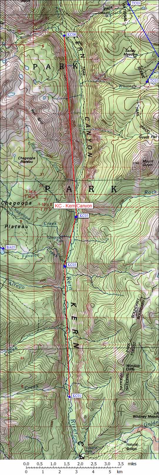
Map exported from TOPO! software, used with permission.
Useful Links: