Bear Box at Onion Valley Trailhead (KA06)
Generated on 2 Aug 2022 - see revision history - please send updates to the webmaster
Detail Map of waypoint KA06
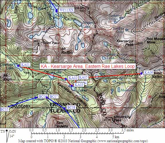
in Kearsarge Area Eastern Rae Lakes Loop:
(scroll down for directions, waypoints, and area map)
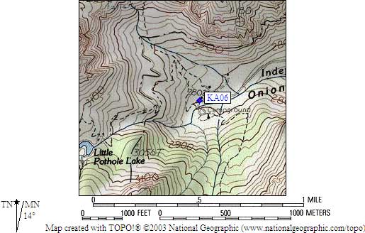
  (lat,lon) = (36.7724600, -118.3409400) in decimal degrees, NAD83.
  (zone,east,north) = (11S, 380411.0, 4070273.0) in decimal meters, NAD27.
Map exported from TOPO! software, used with permission.
Useful Links: