Bear Box at Upper Kearsarge Lake #1 (KA04)
Generated on 5 Jul 2012 - see revision history - please send updates to the webmaster
Detail Map of waypoint KA04
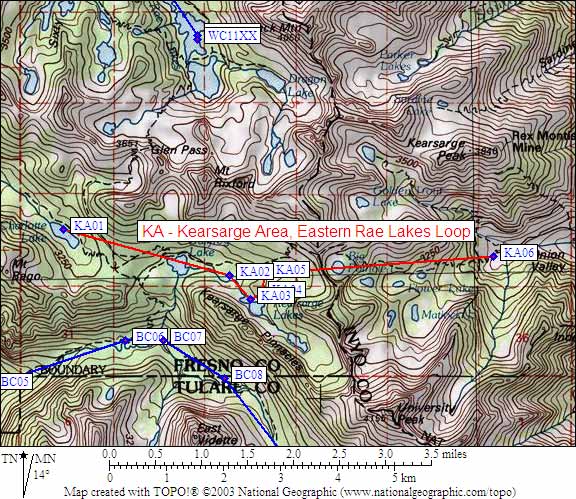
in Kearsarge Area Eastern Rae Lakes Loop:
(scroll down for directions, waypoints, and area map)
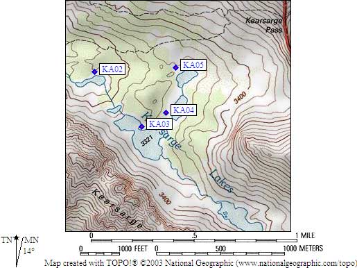
- KA04 is a standard box, at about 10900 feet,
in the GPS route KEARSARGE AREA.
- Directions from Alison Steiner, NPS Wilderness Coordinator, June 2012:
The park is closing the Kearsarge Lakes food-storage lockers for the 2012
season in response to a noted increase in food caching at Kearsarge Lakes.
Caching of materials in wilderness is problematic to park management and
disruptive to park visitors and, as such, is prohibited.
- Directions from Steve Eckert, with GPS waypoint, Aug 2000:
One regular box at the southwest corner of the Kearsarge Lake
second nearest to Kearsarge Pass, about 50 feet from the water.
- Directions from Mineral King ranger info sheet, dated 1991:
One box along the trail between the two small upper Kersarge Lakes.
- KA04 coordinates: (see waypoint and interactive map links above)
  (lat,lon) = (36.7665700, -118.3868900) in decimal degrees, NAD83.
  (zone,east,north) = (11S, 376300.0, 4069678.0) in decimal meters, NAD27.
- Scroll down for a regional map of the entire Kearsarge Area Eastern Rae Lakes Loop region.
Map exported from TOPO! software, used with permission.
Useful Links: