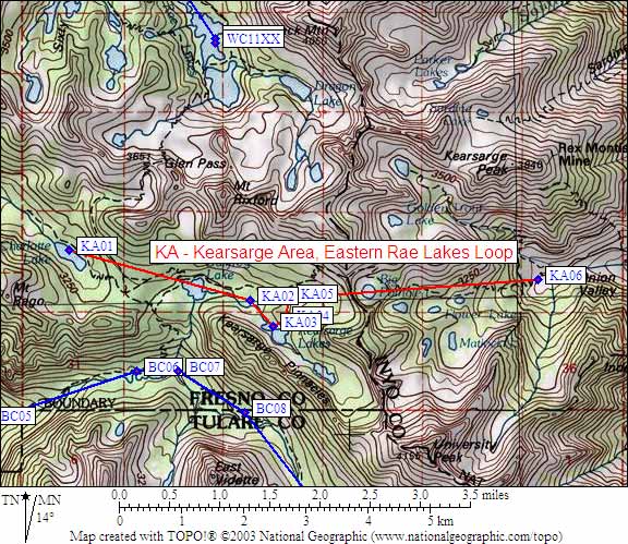
Bear Boxes in Kearsarge Area
Eastern Rae Lakes Loop (KA)
Generated on 2 Aug 2022 - see revision history - please send updates to the webmaster
| 6 Bear Boxes in Kearsarge Area Eastern Rae Lakes Loop - GPS route KEARSARGE AREA | |||||
|---|---|---|---|---|---|
Please let the webmaster know if you can help verify that these boxes exist and precisely locate them. | |||||
Please refer to the individual box pages for details, and let the webmaster know if they are back in service. | |||||
| click on name for details and directions | elevation | waypoint | food locker type | ||
| Charlotte Lake | 10400 | KA01 | a standard box | ||
| Lower Kearsarge Lake | 10800 | KA02XX | a standard box | ||
| Main Kearsarge Lake | 10900 | KA03ZZ | a standard box | ||
| Upper Kearsarge Lake #1 | 10900 | KA04ZZ | a standard box | ||
| Upper Kearsarge Lake #2 | 10900 | KA05ZZ | a large box | ||
| Onion Valley Trailhead | 9200 | KA06 | 8 large boxes plus 8 standard boxes | ||
Useful Links: