Bear Box at Upper Hamilton Lake #3 (HS11)
Generated on 20 Oct 2025 - see revision history - please send updates to the webmaster
Detail Map of waypoint HS11
in High Sierra Trail:
(scroll down for directions, waypoints, and area map)
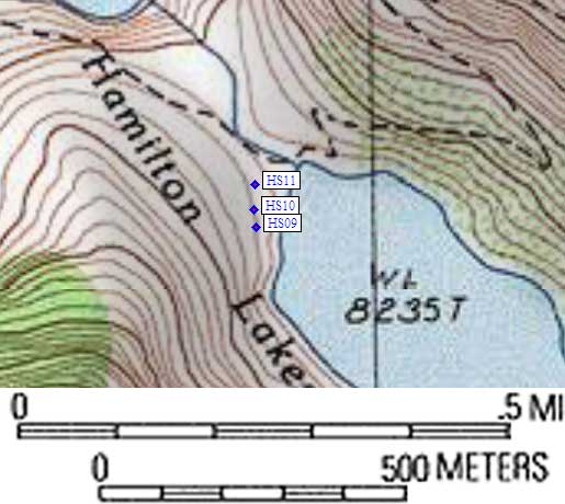
- HS11 is a large box, at about 8200 feet,
in the GPS route HIGH SIERRA TR.
- Note: There are three standard boxes near the outlet of Lake 8235:
two are immediately obvious from the trail, one is a bit obscure.
All three are southwest of where the trail crosses the outlet stream.
- Directions from Gary Craig, with GPS waypoint, August 2002:
This is the northern box, obvious from the trail. There is a map on the signboard
that one sees upon entering the camping area showing the 'official' camp
spots, the boxes, and the outhouse. But I found the map rather confusing.
- Directions from Mineral King ranger info sheet, dated 1991:
Three boxes in the main camp area at the west end of Hamilton Lake.
- HS11 coordinates: (see GPX waypoint download links above)
  (lat,lon) = (36.5639900, -118.5788100) in decimal degrees, NAD83.
  (zone,east,north) = (11S, 358798.0, 4047471.0) in decimal meters, NAD27.
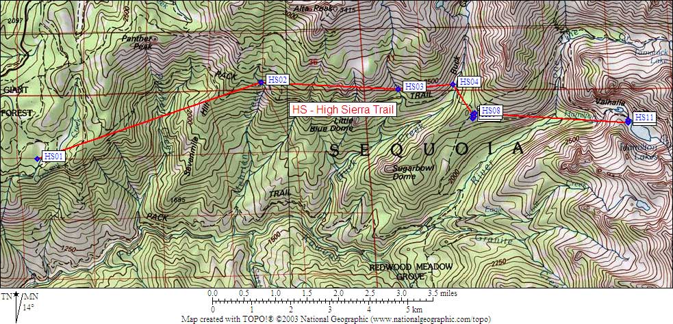
- Scroll down for a regional map of the entire High Sierra Trail region.
Map exported from TOPO! software, used with permission.
Useful Links: