Bear Box at Bearpaw Meadow East (HS07)
Generated on 20 Oct 2025 - see revision history - please send updates to the webmaster
Detail Map of waypoint HS07
in High Sierra Trail:
(scroll down for directions, waypoints, and area map)
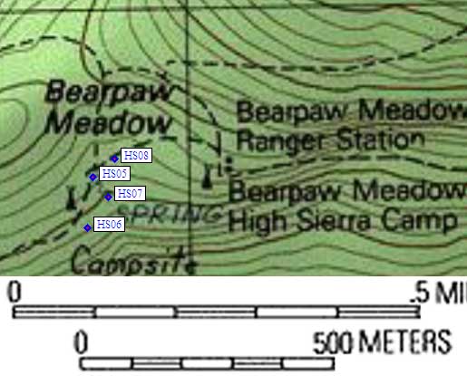
- HS07 is a standard box, at about 7700 feet,
in the GPS route HIGH SIERRA TR.
- Note: The main camp area is pretty large, and is NOT right next to the
dude camp or the ranger station. It's a 600' climb east from Buck
Creek to a trail junction near a saddle, and a sign at the junction
says the campground is 0.1 mile on the southern fork of the trail.
All three trails leaving this junction go downhill! There is a map
on a signboard at the use trail junction near the 'center' of the
backpacker camp giving the locations of the boxes as well as the
location of water and the outhouses, but it doesn't seem accurate.
- Directions from Steve Eckert, with GPS waypoint, Oct 2002:
One box near the center of the Bearpaw Meadow backpacker campsites,
10 yards from the trail, 20 yards east of the campground information
sign (where the use trails tend to converge) and 20 yards west of the
grassy meadow, (near the top end of the meadow - tends to be brushy
higher up). An untreated water spigot is toward the center of the
campground from this box.
- Directions from Mineral King ranger info sheet, dated 1991:
Four boxes in the main camp area.
- HS07 coordinates: (see GPX waypoint download links above)
  (lat,lon) = (36.5648200, -118.6231800) in decimal degrees, NAD83.
  (zone,east,north) = (11S, 354829.0, 4047629.0) in decimal meters, NAD27.
- Scroll down for a regional map of the entire High Sierra Trail region.
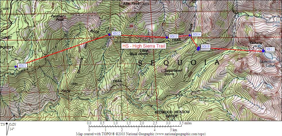
Map exported from TOPO! software, used with permission.
Useful Links: