Bear Box at Rock Camp NW (HP07)
Generated on 20 Oct 2025 - see revision history - please send updates to the webmaster
Detail Map of waypoint HP07
in Hockett Plateau:
(scroll down for directions, waypoints, and area map)
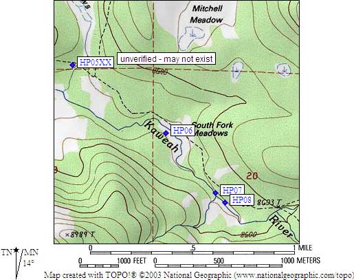
- HP07 is a standard box, at about 8600 feet,
in the GPS route HOCKETT PLATEAU.
- Note: Southeast and Northwest Rock Camp boxes are about 100 yards apart.
Between them the trail goes over a log-and-plank footbridge. Waypoints
are hard to get here due to the tall trees.
- Directions from Steve Eckert, with GPS waypoint, June 2001:
One box about 10 yards from the stream that drains the meadow,
and 50 yards from the edge of the meadow itself. There is a
horse hitching rail here, and large camp with lots of logs
to sit on, but only the hitching rail is barely visible from
the trail just north of the footbridge. About 50 yards north
of this camp is a huge boulder field (east of the trail) with
no trees and 10' boulders stacked against each other.
- Directions from Mineral King ranger info sheet, dated 1991:
Two boxes, one at each of TWO camps between the trail and the meadow
about one fourth of a mile north of Hunter Creek.
- HP07 coordinates: (see GPX waypoint download links above)
  (lat,lon) = (36.3426400, -118.6404000) in decimal degrees, NAD83.
  (zone,east,north) = (11S, 352871.0, 4023006.0) in decimal meters, NAD27.
- Scroll down for a regional map of the entire Hockett Plateau region.
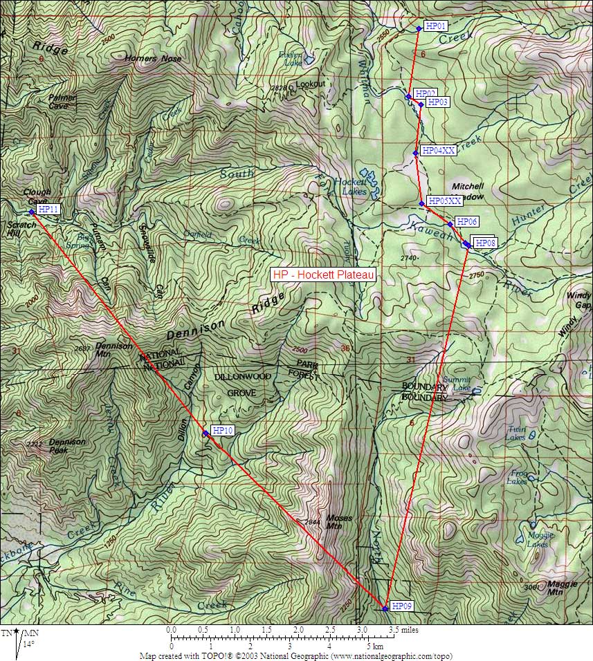
Map exported from TOPO! software, used with permission.
Useful Links: