Bear Box at South Fork Meadow (HP06)
Generated on 2 Aug 2022 - see revision history - please send updates to the webmaster
Detail Map of waypoint HP06
in Hockett Plateau:
(scroll down for directions, waypoints, and area map)
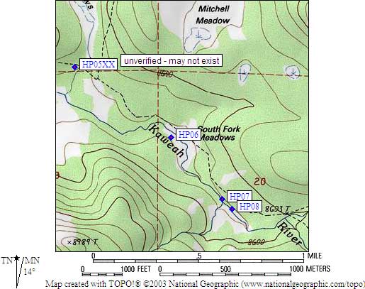
- HP06 is a standard box, at about 8500 feet,
in the GPS route HOCKETT PLATEAU.
- Note: You must cross stream to get to a large horse campsite from the trail.
The box and the camp are hard to see through trees and across stream,
but there is a horse-friendly ford and some downed trees I crossed near
the outlet of the meadow. This camp is just south of the signed trail
junction to Touhy River, but beware: that trail is not on the 7.5 quad
so don't take it if you intend to go to Hockett Lakes.
- Directions from Steve Eckert, with GPS waypoint, June 2001:
One standard box at the northwest (outlet) end of Southfork Meadow.
The box is southwest of the stream in the middle of the campsite.
- Directions from Mineral King ranger info sheet, dated 1991:
One box at the main stock camp on the west side of the river
near a large rock and visible hitch racks.
- HP06 coordinates: (see GPX waypoint download links above)
  (lat,lon) = (36.3468500, -118.6447400) in decimal degrees, NAD83.
  (zone,east,north) = (11S, 352489.0, 4023479.0) in decimal meters, NAD27.
- Scroll down for a regional map of the entire Hockett Plateau region.
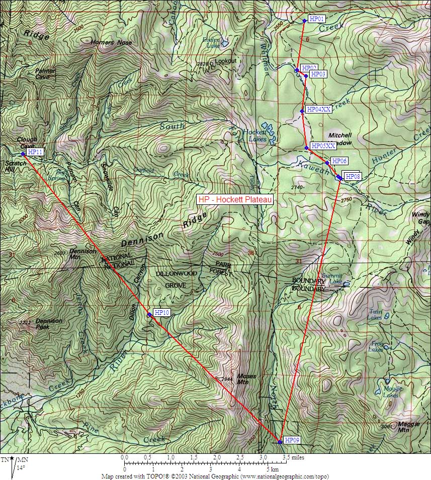
Map exported from TOPO! software, used with permission.
Useful Links: