Bear Box at Frypan Meadow (CG01)
Generated on 20 Oct 2025 - see revision history - please send updates to the webmaster
Detail Map of waypoint CG01
in Cedar Grove Area:
(scroll down for directions, waypoints, and area map)
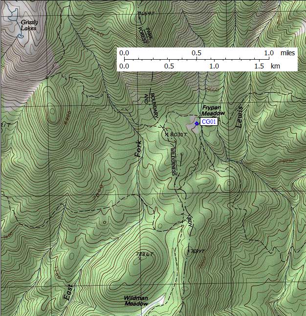
- CG01 is a standard box, at about 7800 feet,
in the GPS route CEDAR GROVE.
- Note: The trail on the map is wrong! The 2010 GPS waypoint is a major correction
of the older waypoint. Also, Frypan Meadow is labelled poorly on the map: it is
actually the white clearing southwest from the label (which appears over a ridge).
- Directions from Steve Eckert, with GPS waypoint, June 2011:
One box in tall trees between Frypan Meadow and the second stream west of Lewis Creek.
This box is 0.15 miles north of the Lewis Creek / Wildman Meadow trail junction,
and 100 yards south of the poorly marked Kennedy Pass / Grizzly Lakes trail junction.
Look for two massive trees that fell at right angles in 2011, one going all the way across
the meadow, and find the bear box near the hole their roots left. The trail along the
meadow was obliterated in 2011 when a large number of very large trees fell.
You will miss the box if you follow the Grizzly Lakes sign immediately north of Wildman Meadow.
- Directions from Aaron Schuman, October 2002:
It's in a soothing grove of trees, in between
the trail and the creek, about five meters from each
landmark. It is easily visible from the trail.
- Directions from Steve Eckert, with GPS waypoint, June 1998:
One box in a very small meadow south of ONE OF THE POSSIBLE Grizzley Lakes trail junctions.
- CG01 coordinates: (see GPX waypoint download links above)
  (lat,lon) = (36.8535600, -118.6985600) in decimal degrees, NAD83.
  (zone,east,north) = (11S, 348653.0, 4079776.0) in decimal meters, NAD27.
- Scroll down for a regional map of the entire Cedar Grove Area region.
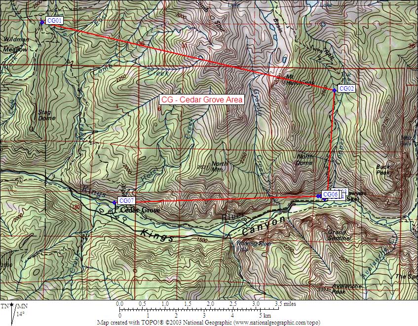
Map exported from TOPO! software, used with permission.
Useful Links: