Bear Boxes in Big Pine Creek Drainage (BP)
Generated on 2 Aug 2022 - see revision history - please send updates to the webmaster
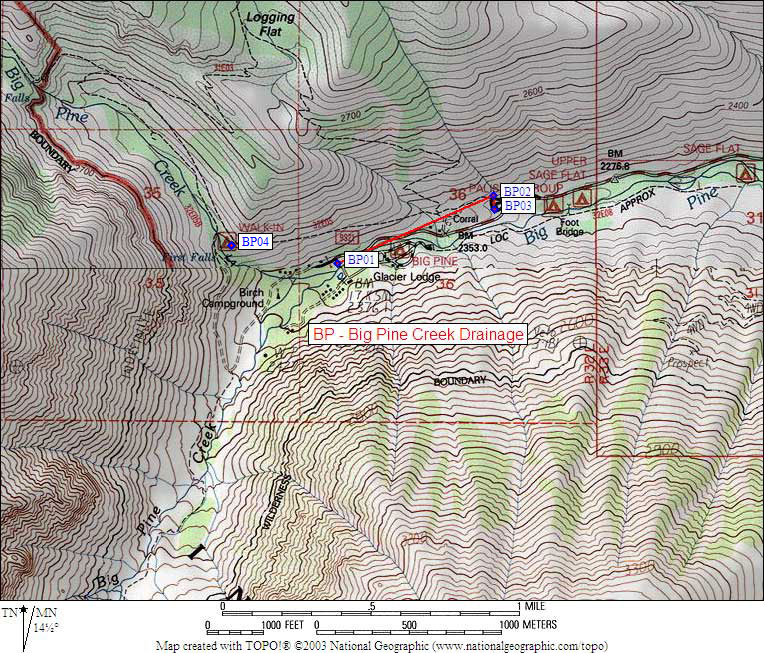
| 4 Bear Boxes in Big Pine Creek Drainage - GPS route BIG PINE AREA | |||
|---|---|---|---|
| click on name for details and directions | elevation | waypoint | food locker type |
| North and South Fork Trailhead | 7800 | BP01 | 1 standard box |
| Upper Backpacker Parking Lot | 7700 | BP02 | 2 standard boxes |
| Lower Backpacker Parking Lot | 7700 | BP03 | 4 standard boxes |
| Walkin Campground | 8200 | BP04 | 1 standard box |
Useful Links: