Bear Box at Lower Vidette Meadow (BC06)
Generated on 2 Aug 2022 - see revision history - please send updates to the webmaster
Detail Map of waypoint BC06
in Bubbs Creek Southern Rae Lakes Loop:
(scroll down for directions, waypoints, and area map)
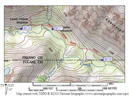
- BC06 is a standard box, at about 9500 feet,
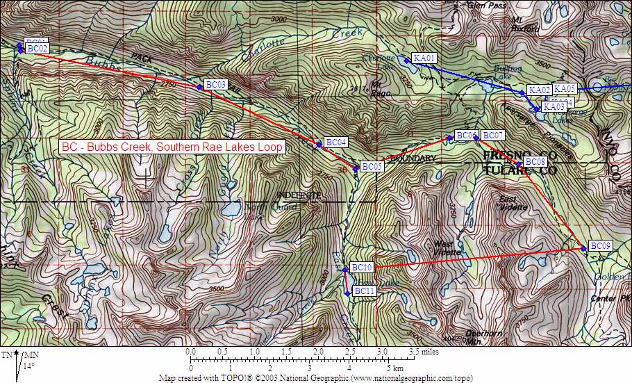
in the GPS route BUBBS CREEK.
- Directions from Scott Sullivan, with GPS waypoint, Aug 2000:
From the intersection of the John Muir Trail and the [Bubbs Creek] trail
from Road's End/Junction Meadow, go WEST just over a tenth of a mile on
the trail toward Junction Meadow, the bear box is 20 feet south of the
trail at the west end of the meadow in a very established camp area.
- Directions from Mineral King ranger info sheet, dated 1991:
One box north of the trail in Lower Vidette.
- BC06 coordinates: (see GPX waypoint download links above)
  (lat,lon) = (36.7591200, -118.4137900) in decimal degrees, NAD83.
  (zone,east,north) = (11S, 373884.0, 4068888.0) in decimal meters, NAD27.
- Scroll down for a regional map of the entire Bubbs Creek Southern Rae Lakes Loop region.
Map exported from TOPO! software, used with permission.
Useful Links: