Bear Box at Charlotte Creek (BC03)
Generated on 2 Aug 2022 - see revision history - please send updates to the webmaster
Detail Map of waypoint BC03
in Bubbs Creek Southern Rae Lakes Loop:
(scroll down for directions, waypoints, and area map)
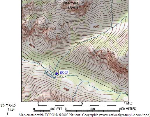
- BC03 is a standard box, at about 7300 feet,
in the GPS route BUBBS CREEK.
- Note: The Sequoia Natural History Assoc map shows this box on the
south side of Bubbs Creek, but that's not accurate - it's
between the trail and Bubbs, not on the far side of Bubbs.
- Directions from Steve Eckert, with GPS waypoint, August 2004:
One standard box about 50 yards east of Charlotte Creek and about
50 yards north of Bubbs Creek, just uphill from a huge fallen tree.
There are two streams, Charlotte Creek is the one with the log bridge.
Better campsites are west of Charlotte, but the box is to the east.
A small sign just east of the creek shows the box location, and a
use trail drops below the main trail to the box.
- Directions from Mineral King ranger info sheet, dated 1991:
One box below the Bubbs Creek trail, east of the Charlotte Creek crossing.
- BC03 coordinates: (see GPX waypoint download links above)
  (lat,lon) = (36.7706800, -118.4852000) in decimal degrees, NAD83.
  (zone,east,north) = (11S, 367533.0, 4070265.0) in decimal meters, NAD27.
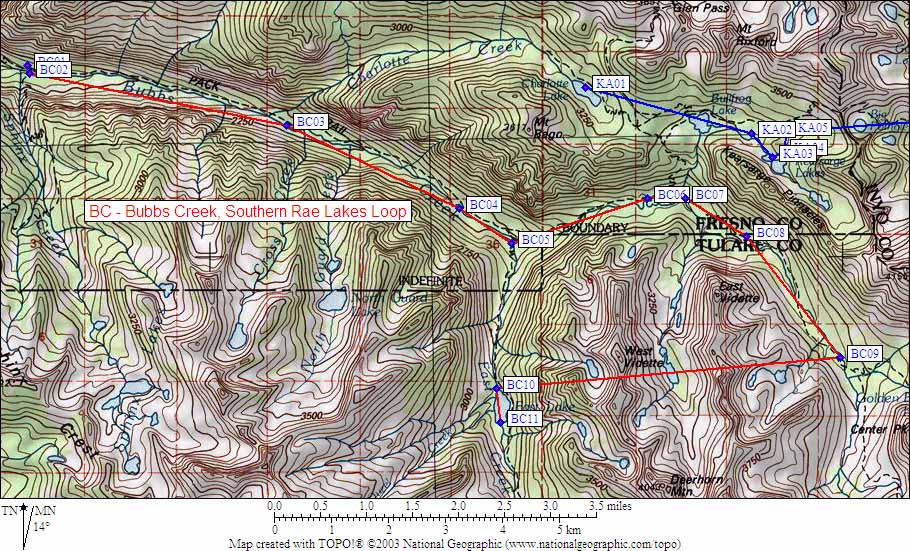
- Scroll down for a regional map of the entire Bubbs Creek Southern Rae Lakes Loop region.
Map exported from TOPO! software, used with permission.
Useful Links: