Bear Box at Bubbs Creek at Sphinx Creek (BC01)
Generated on 20 Oct 2025 - see revision history - please send updates to the webmaster
Detail Map of waypoint BC01
in Bubbs Creek Southern Rae Lakes Loop:
(scroll down for directions, waypoints, and area map)
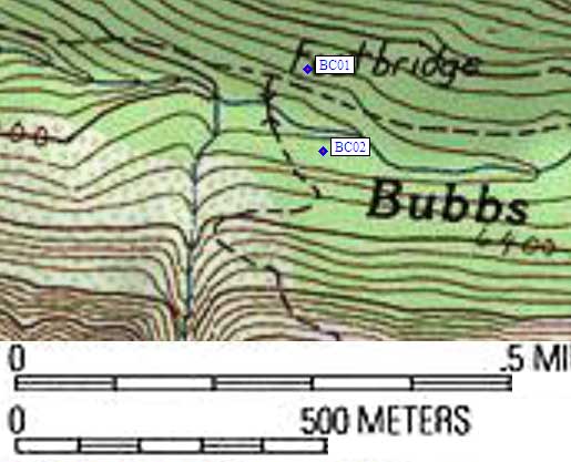
- BC01 is a standard box, at about 6300 feet,
in the GPS route BUBBS CREEK.
- Directions from Steve Eckert, with GPS waypoint, June 1999:
One standard box in the campsite 50 yards from the bridge at the Bubbs/Sphinx
trail junction at a bearing of 40 degrees from the bridge, north of Bubbs
Creek, east of the trail junction. If this box is full, try BBBC02 which
is only a tenth of a mile away but harder to find.
- Directions from Tony Cruz, May 1999:
The bear box is on the Bubbs Creek trail, just beyond the bridge
over Bubbs Creek which marks the intersection with the Sphinx
Creek trail. It can be seen less than 100 yards from the spot where
one naturally drops the pack to get a breather before crossing the
bridge, leaving the Bubbs Creek Trail and taking the Sphinx trail.
The box is right in the middle of a large shaded camping area big
enough to sleep 20 people.
- Directions from Mineral King ranger info sheet, dated 1991:
One bear box above the Bubbs Creek trail east of the Sphinx Creek crossing.
- BC01 coordinates: (see GPX waypoint download links above)
  (lat,lon) = (36.7802006, -118.5363666) in decimal degrees, NAD83.
  (zone,east,north) = (11S, 362980.0, 4071395.0) in decimal meters, NAD27.
- Scroll down for a regional map of the entire Bubbs Creek Southern Rae Lakes Loop region.
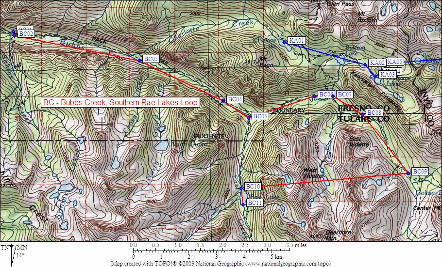
Map exported from TOPO! software, used with permission.
Useful Links: