| NOTES:
|
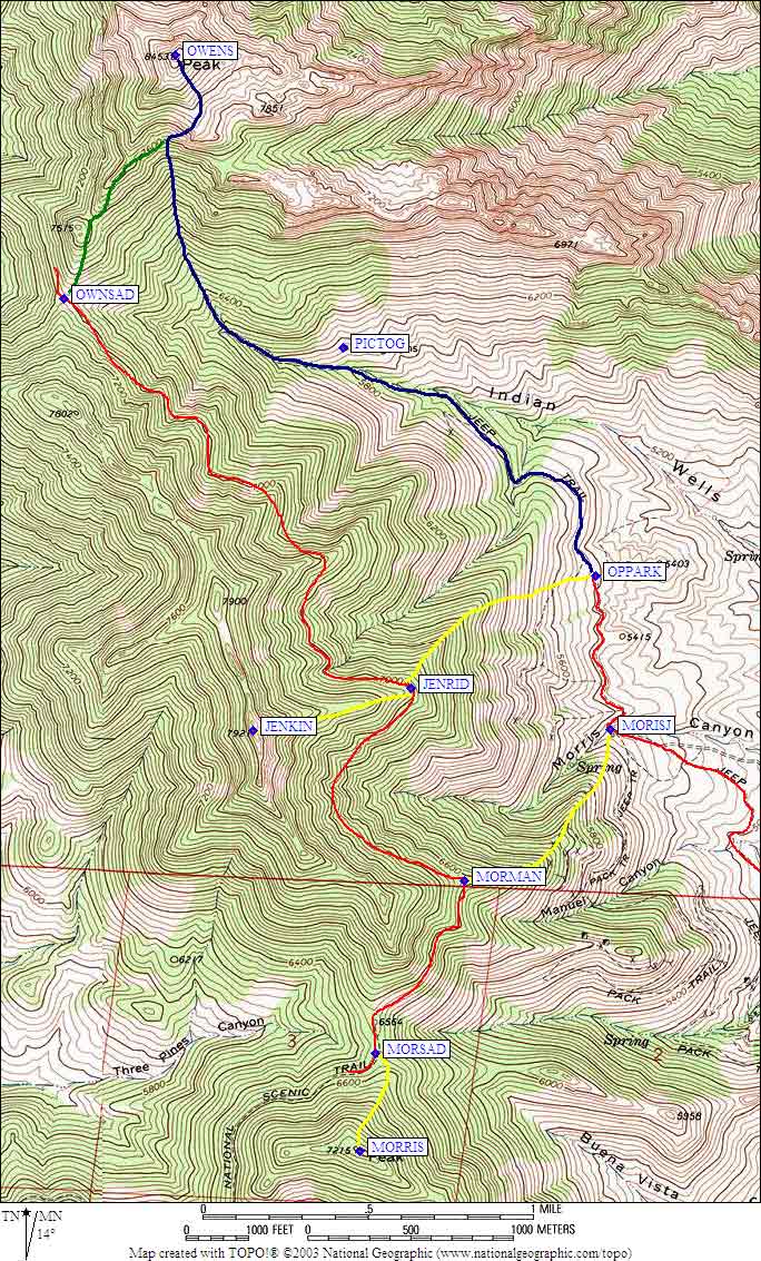
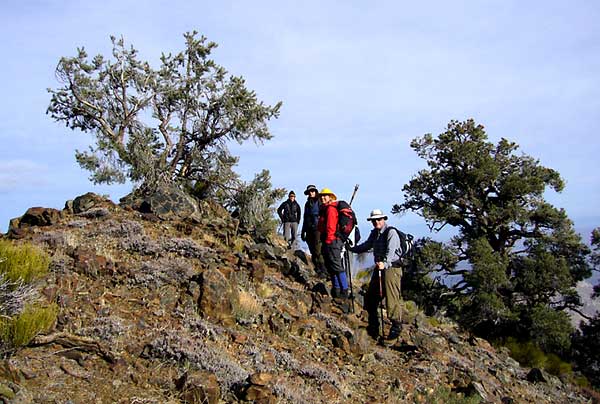
Five Fingers (with route)
27 January 2006: After a 7 hour drive from San Jose, we met at noon at Waypoint POWERS, just short of the Hwy 14-395 junction. The road up to that point is navigable with a street auto; after that, a 4WD or high clearance 2WD vehicle is required as there are shallow creeks to cross. POWERS is 2.7 miles from the pavement on a wash-boarded road. There is an old square rock-walled cistern just past the small cofferdam, on the left. It's a great place to meet. We met at noon; decided to climb Five Fingers, a granite complex of eroded batholithic granodiorite. Deserts can make distances very deceiving; the peak looked like it was 500' above us, although it's about 1000 feet above the trailhead and a very fun climb. It took us about 2 hours round trip to climb, with a very low 3rd class summit block. The Route climb up the South face to a notch between the high point which is the index finger to the right of the thumb; it is marked by a squarish block of granite. Once at this square notch; go around to the North side of the mountain; you will see an obvious chute after about 150 yards; go up this chute; as you near the top you will see human-cut half-moon steps in the granite in a low 3rd class chimney; the summit is very easily reached; for the descent, we sand-jumped down the southwest face, and drove to our campsite.
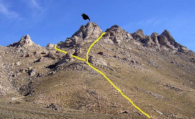
Part of camp
The camp at Waypoint OPPARK is 7.2 miles from the pavement further on down SE164; see the excellent Trailhead directions on the climber.org website. The campsite is a large set of granite formations, with 2 Coulter Pines. It's also the Trailhead for Owens Peak. There are adjacent spots for parking; also several flat spots to the East about 100 yards from the parking area. The granite formations are wind-eroded and quite beautiful. Temperatures hovered within 40 F; however, there was a 20-25 mph wind, which made it a bit chilly. Cover from wind can be found in the complex of boulders; also, a kitchen can be set up as well. A clear view of the peaks showed light snow on the northeastern faces, none at all on the southern exposures, so we decided to go without snowshoes. This trip doesn't require crampons or ice axe unless you're trying a northern exposure; even then, there wasn't that much snow.
Owens from south on PCT
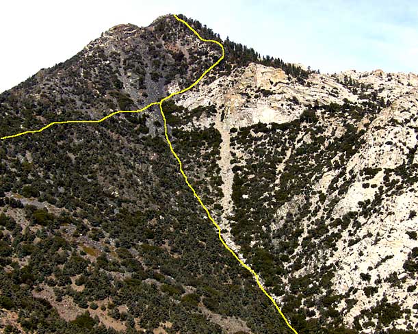
Saturday, January 28th: Owens Peak, 8453, Jenkins Peak, 7921. We arose bright and early at 530 am for a 700 am start. We hiked up the Owens Ck Canyon from the trailhead. The trail follows the creek bed (dry at this time of the year) up to approximately the 7800 foot level. This is a use trail, easy to follow at the bottom, harder to follow at the upper reaches. At this point you start climbing up the left hand side of the ridge, below a striped and banded rock pinnacle formation that is a summit roof pendant. The striping and banding is characteristic of a roof pendant' rock formations comprised of metamorphasized sedimentary rocks that were former continental shelf seabed. The Granite Batholith came in under the folded seabed, which composed the ancestral Sierra prior to the granitic intrusions. Roof pendants are common, particularly in the southern and eastern Sierra. When you get about 500' below a false summit roof pendant, cut to the right across a dark banded talus field composed of slate, another metamorphic rock. On the right, you will see a very prominent granite outcrop where there is a use trail. The use trail is right below the granite outcrop on the right hand (northern) ridge. This use trail leads directly to the summit, and the summit is also a roof pendant, sitting on the granite batholith. We arrived at the summit at 10:00 am; early; as a result, we decided to climb Jenkins peak, to the south of Owens peak. To get to Jenkins peak, you drop to a saddle to the south of Owens Peak between it and Jenkins Peak. You can clearly see the snow-covered PCT on the East side of Jenkins, and it crosses onto Jenkins at the saddle. From Owens Peak, the ascent ridge is obvious; once you reach the saddle, get on the PCT for about 2 miles. The snow was about a foot deep in places, but snowshoes weren't required. Before we chose the route we eventually took, we discussed going up a southeast facing slope, which we probably could have taken; but the northern ridge of Jenkins also has a rocky, CL3-5 spine, so you would want to stay at the base of the spine and traverse in a southerly direction to Jenkins summit. Eventually, we reached the chosen ascent ridge, distinguished by a rocky spine. When you reach the base of it, you'll want to follow a use trail up the south side of the spine. This trail leads directly to the summit, which we reached at 1:30 PM. These peaks are transitional peaks between familiar southern Sierra Peaks and Sky Islands of the Sonoran Desert; as a result, this area has a very unusual variety of endemic plant, a variety of unusual yuccas, and in Jenkins case, a Joshua tree just below the 7921' high summit. There are also some unusual relict White Firs along the PCT. During the Ice ages, this area was quite wet and these firs are descendents of the former floral expansion. Jenkins peak, formerly called N. peak, Morris, was named after a naturalist and climber named Jim Jenkins, who died in 1979 in a car accident. His mother, the famous Ruby Jenkins, and others petitioned the US Board of Geographic Names to change the name, and succeeded in doing so in 1984. The summit register is particularly interesting as there is a copy of the name transfer papers.
After Jenkins, we were able to return to camp by 3:30 PM. It was very cold and windy, even windier than the previous day; but we were able to make a fire in a notch in the granite boulders after a rousing supper. We decided to climb Morris, the last peak on our clean-out list, the following day.
On the way to Morris, just below PCT
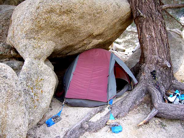
Sunday, January 29th, started with a wonderful sunrise, the wind had died overnight. At 7:30 AM, In order to get to the peak, we drove about 1 mile to a creek crossing, where we parked and climbed a spiny ridge to Morris. On the way up, we passed several signs marking the Blue Max mine, as well as several mine structures, loading bins, and mine shafts. You'll go up the obvious ridge on the topographic map, intersect the PCT, hike about 1 mile south, then climb the obvious ridge to the Morris Summit, which we reached at 10:00 am. We were back in camp by noon, and packed up and drove home. I highly recommend this trip because for those who are snow-bound, or want a taste of summer-like hiking, this is a very fun trip. Temperatures in the dry air rarely got above 50F, but the dryness and sunshine make it feel like a summer jaunt. This trip featured easy access, some great rock climbing if you desire, and satisfying peak bagging. Owens peak is even on the SPS List!
Route map for all peaks except Five Fingers: