Friday, 19 October 2001

|
Our second highpointing trip of the year was squeezed into a long weekend, using my last day of vacation and Nathan's only days off between Labor Day and Thanksgiving. Guadalupe Peak, the Texas highpoint, is one of the most geographically isolated, being about 100 miles east of El Paso and a good 400 miles from the next nearest highpoints, Wheeler Peak in New Mexico and Black Mesa in Oklahoma. With low airfares available, the expedient means of checking off Guadalupe Peak was to treat it as a single-purpose trip and not try to combine it with other highpoints on one of our epic car trips. |
We flew from St. Louis to El Paso via Dallas. Between ticketing confusion arising from the merger of TWA and American Airlines and the heightened security following the terrorist attacks of September 11, getting there was not half the fun, but we managed to make it in good order nonetheless. A short drive to the Holiday Inn near the airport, and we settled down to catch a few hours' sleep before the adventures of the morrow. |
|
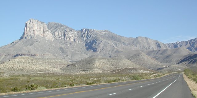
The Guadalupe Mountains rise precipitously from the west Texas plains. The ridge is visible shortly after you leave El Paso eastbound on U.S. highway(s) 62/180. As you swing around the south end of the ridge, the sheer face of El Capitan is quite impressive in front of the taller but gentler Guadalupe Peak. |
|
|
|
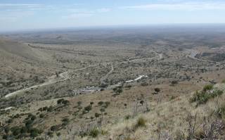
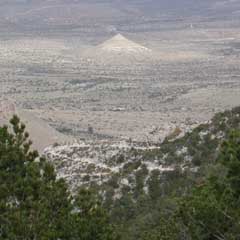
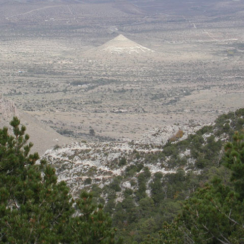
Looking back after the first mile or so up the trail, you can see U.S. 62/180 snaking into this view from the right. The Guadalupe Mountains National Park visitors center is in the lower center and the trailhead at 31 53.793'N, 104 49.659'W takes off from the left end of the RV parking area just left of and below center. The area is every bit as desolate as it appears. Although rattlesnakes are supposedly common in this part of Texas, we saw no sign of them during our hike. |
|
|
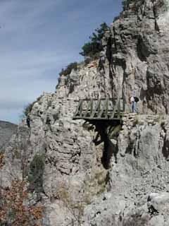
As we approached the final stretch to the summit, we came across a bridge over a narrow ravine. At points near this area, the trail is blasted out of the face of a cliff and the exposure on the downhill side is impressive. It is always a good trail, but if walking along a four foot wide ledge with a couple of hundred feet of air beside you spooks you, these spots will seem a bit dicey.
|
|
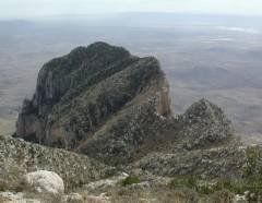
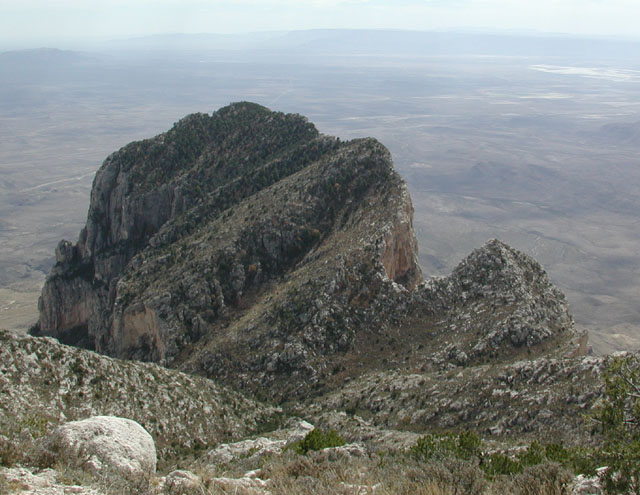
The trail drops perhaps 50 feet after crossing the ridge after the bridge but then quickly makes up the lost altitude. From that part of the trail, the view of the north side of El Capitan shows that it is a rugged outcrop from any direction you might care to approach. Fortunately, the route up Guadalupe Peak is not nearly so threatening. |
|
|
|
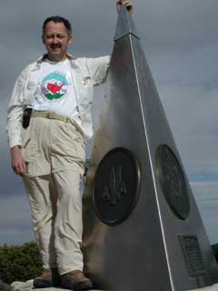
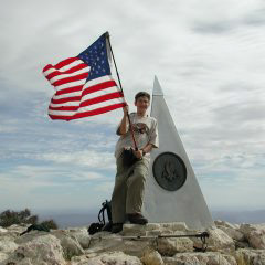
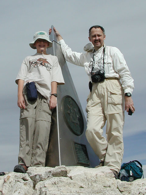
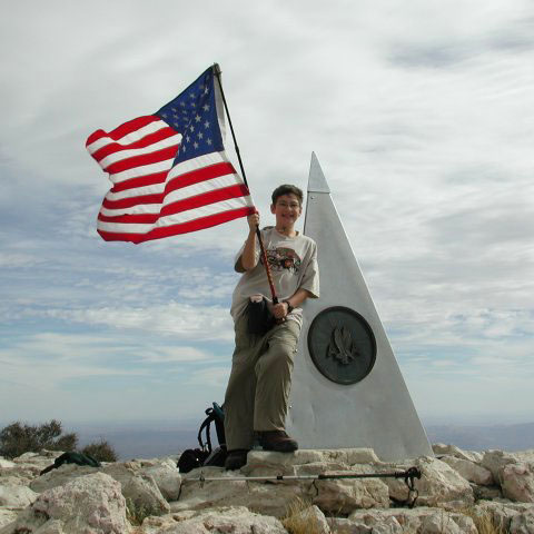
In remembrance of those who lost their lives on September 11, 2001, the Highpointers Club has asked its members to carry a U.S. flag to the summits of the 50 states. We did so and it flew proudly in the stiff breeze atop Guadalupe Peak. |
|
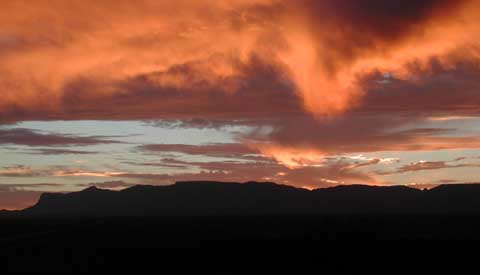
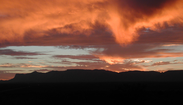
Looking back down the valley toward the trailhead, some of the many switchbacks are evident in the foreground of the shot on the right. There are several conical hills nearby like the one in the background, but according to the USGS topographic map, this particular one is most aptly named "Nipple Hill." We dumped our packs in the car and headed north on U.S. 62/180 towards Carlsbad Caverns. About halfway there, we were treated to the spectacular sunset below. El Capitan is the nearly vertical face at the left edge of the photo. Guadalupe Peak is the prominent peak just to the right of El Capitan. |
|
|
|
|
|
Our other destination for this trip was Carlsbad Caverns. We chose to stay in the nearby "Cavern Inn" which is part of a delightfully tacky and touristy set of facilities at the intersection of Hwy 62/180 and the road back into the Carlsbad Caverns National Park. |
|
|
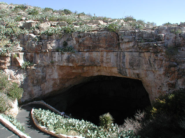
From the surface, Carlsbad Caverns appears as this gaping maw leading down nearly 800 feet underground. The tour schedule led us first to take the easy way down using the elevator in the visitors center, to tour the "King's Chamber," one of the large rooms of the caverns. After that, we rode back up and walked down the natural entrance route, following a series of switchbacks down and nearly a mile into the caverns, into the "Big Room." |
|
|
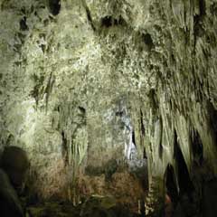
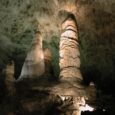
Once into the main part of the caverns, you are presented with a bewildering array of different formations, just a few of which are illustrated here. The trails through the caverns are paved and provided with handrails, prompting the curious to wonder how the caverns might appear without such drastic human intervention. |
|
|
We spent the entire day meandering around underground, fascinated by the many and varied sights. As dinner time approached, we headed north on Hwy 62/180 again into the city of Carlsbad, where we found a Mexican restaurant and watched a baseball playoff game on the big-screen TV as we ate dinner. We returned to our motel to pack and prepare for our return home on Monday. |
||
Monday, 22 October 2001
|
Our drive back to El Paso was uneventful, but the flight home proved to be interesting. The flight to Dallas left on time and landed about five minutes early. Then we sat on the tarmac for 45 minutes, waiting for a gate to be available. Needless to say, that blew our connection to St. Louis, but there was another flight an hour later with space available. Of course, it took a few trips back and forth between TWA and AA gates to get the cross-booked tickets straightened out, so we barely had time to grab pizzas from the conveniently-located Pizza Hut next to our departure gate before it was time to board the flight home. (In case you haven't flown TWA recently, they have pulled a Southwest move and have stopped meal service on all of their domestic flights. If you want to eat on board, BYO!) We arrived home a bit late but otherwise none the worse for wear. One more state highpoint under our belts...it must be time to start planning the next trip! |
The Approach and Trail to Guadalupe Peak
|
This El Capitan may lack the sheer vertical expanse of granite of its taller brother in Yosemite National Park, but rising as it does from the desert 100 miles east of El Paso, it is an impressive landmark nonetheless. This limestone formation is the remnant of an ancient reef which extended in a huge horseshoe for nearly 400 miles through what is now Texas. It gave rise not only to these mountains but through the action of sulfuric acid formed by gasses percolating up from underlying oil and gas deposits, produced Carlsbad Caverns. |
|
The trail rises rapidly up a series of switchbacks from the trailhead and you soon have this panoramic view which includes the isolated civilization of the Guadalupe Mountains National Park visitors center, its parking lot and a lot of miles and miles of nothing but miles and miles. |
|
Along one of the more rugged stretches of trail, some of which is blasted out of the face of a cliff, you cross this bridge over a narrow ravine. From here, the trail drops down a bit before the final stretch up to the top of Guadalupe Peak. This was a convenient spot for lunch, being on the leeward side of a ridge and having nice flat rocks on which to rest. |
|
After lunch, we crossed over the ridge and resumed the ascent toward Guadalupe Peak. The rugged north side of El Capitan was visible below the trail. From the looks of it, it would be a challenge to approach from either side. |
|
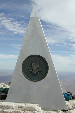
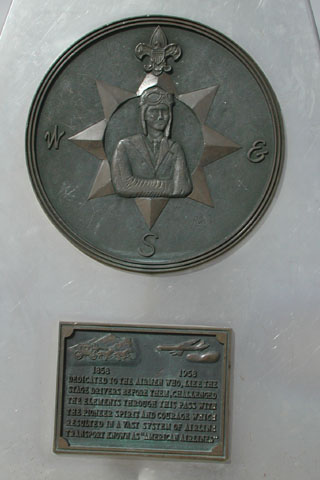
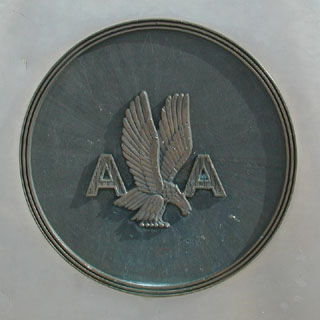
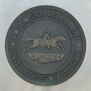
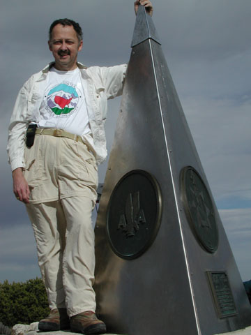
It is obvious when you have reached the summit, thanks to American Airlines' placing this stainless steel obelisk on the highest point of the peak. |
||||||
|
|
||||||
|
|
||||||
|
When ascending to the highpoint of one of the 50 states, one must conform to the appropriate dress code, that being a Highpointers Club t-shirt! |
||||||
|
While there may not be the 98 switchbacks of the Mt. Whitney trail, the hike up Guadalupe Peak involves its fair share of back and forth. |
||||||
|
The clouds which had been slowly thickening overhead as we were on the summit and trail back broke just enough for a spectacular sunset as we drove up toward Carlsbad Caverns. |
||||||
Flying the Flag atop Guadalupe Peak
|
|
Flying the Flag atop Guadalupe Peak, |
|
 |
|
When Nathan and I hiked to the top of Guadalupe Peak, the Texas state highpoint, we carried our U.S. flag with us to fly from the summit in remembrance of those who lost their lives in the World Trade Center and Pentagon attacks of September 11, 2001. |
|
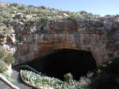
There was an amphitheater behind me as I took this shot, from which people can watch the hundreds of thousands of Mexican free-tailed bats leave on their evening feeding expeditions during the summer. Fortunately, the bats take a left upon returning to the caverns, into their own section of the caverns, rather than following the route down to the right, which is the passage from this entrance into the main part of the caverns. By late October, there are only a few hundred bats left to see, so we were too late in the season for the full show. |
|
One cannot tour any cave without hearing the standard spiel about how to tell a stalactite from a stalagmite. Even Nathan already knew that a stalactite has to hold on tight to the ceiling or it might fall, while a stalagmite might grow to reach the ceiling someday. |
|
Many bizarre formations are down there to be seen. These cave curtains form along sloping areas of the ceiling where a source of water clings to the ceiling for a time before dripping off. All of the major formations consist of minerals dissolved from the overlying rocks by groundwater percolating down and reaching the caverns. As it drips from the ceiling, some minerals precipitate because of outgassing of carbon dioxide, causing the minerals dissolved by the weak carbonic acid to be deposited. Depending on how fast the water drips, simple evaporation contributes to the process, as well. |
Carlsbad Caverns in its Natural State
|
|