A couple of years ago, I stimulated interest in this route. Joe Stephens, who has climbed every Sierra peak I've ever heard of and many that I haven't, suggested it. I assembled a group of nine climbers including Steve Eckert and in April 1995 we were treated to an awful bushwhack up to 9,200 feet. The next morning we made a summit attempt. I slogged to a saddle at about 11,300 feet where I watched in awe as Steve and some of the others climbed onto the first steep snow and rock in a howling wind which was so strong it could support much of my weight. I retreated as a whiteout overcame us. No one summitted.
In the spring of 1996, I assembled another group of climbers, including Steve and Rich Calliger. Rich started the trip a few days ahead of us, pushing up the drainage with his cell phone to nearly 9,000 feet. From there he reported that conditions were bad. The rest of us already suspected as much and we scratched the trip. A couple of weekends or so later, Steve led a group that completed the climb. I broke my finger prior to this success and another spring passed without even an attempt by me.
Finally in June 1996, I climbed Williamson but it was via the normal (Bolton Brown) route via Shepherd Pass. The George Creek route is not legally accessible in the summer in order to protect the Big Horn Sheep habitat.
Which brings me to the spring of 1997. I put out another trip announcement for George Creek. Rich Calliger, Mike Rinaldi, Pat Ibbetson, Elmer Martin, and Nick Piltch responded. After a million emails and one postponement, we finally set off on May 9.
Rich carpooled from the Bay Area in his new Land Rover with Nick and Mike. The rest of us drove solo; Elmer Martin from Southern California, Pat Ibbetson from Fresno and myself from San Jose. Rich's crew arrived in the afternoon and had barbecued steaks and beer at the trail head. I arrived at Lone Pine at 9 p.m., where I met Elmer in a giant Suburban he had rented for the occasion. I left Pat a note and issued myself a permit at the ranger station. We drove north and turned into the Manzanar National Monument (where they interred the Japanese during WW2). Elmer expertly drove us to the trailhead without a false turn.
About an hour later a guy with an enormous external frame pack appeared out of the darkness and asked for Tony Cruz. I asked him if he was Pat and kicked myself for not realizing I saw him a couple hours earlier at the ranger station. We had given each other funny glances but neither said anything. Pat had taken a wrong turn and parked his car about 45 minutes downhill next to the creek. He had seen the lights of the Suburban and followed them up the hill. On our way out it turned out to be a stroke of luck that Pat had taken his car most of the way to the trailhead.
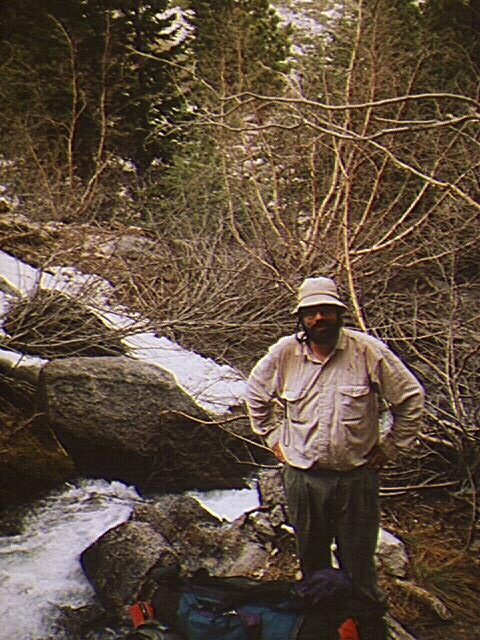
Saturday morning May 10 we woke up at 5 a.m., but in typical PCS fashion didn't hit the trail until 6:30. Rich and I led the way up the north side of the creek until the pathetic remnant of a trail petered out. I wasted 20 minutes scouting a way on the north side. When I returned to the group, most were already across the stream at a place where the drainage narrowed to a slot a few dozen yards wide. Rich grabbed my pack and was surprised at how light it was (35 pounds max). Rich also grabbed my arm and pulled me across the stream.
There we found another trail remnant and hiked into an area with tall pines. After climbing over a rock and another easy obstacle, we crossed north again on an enormous log. Shortly after that we did the only significant bushwhacking we had to do all day (in contrast to my first trip in which we bushwhacked for hours). At one point I managed to fall off a log, rear end first into some thorny manzanita bushes. Ouch!
Elmer found a way across the stream and we crossed to the south again. The spot was covered with willows on both sides and marked with a tall dead tree in the middle. Shortly after that we stopped on a boulder field and had lunch at about 11 a.m.
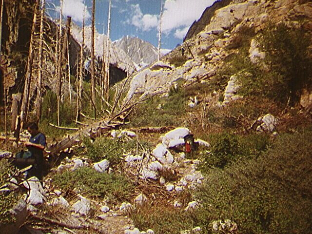
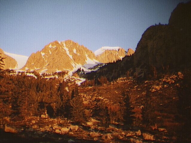
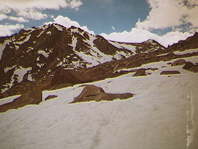
We continued up the drainage, staying high on the south side until we reached about 8,900 feet, where we did our final stream crossing below a waterfall. At this point, Elmer said that he was tired of the bushwhack and fed up with mountaineering in general. He said that he was having a mid-life crisis and had determined that the high peaks were no longer for him. He insisted on going no higher but after much persuasion on my part, Elmer agreed to go up the hill to the ideal campsites at 9.200 feet.
We decided to go no further that day even though we had hours of light left. Rich complained of back muscle spasms and felt sick. Pat said he also had spasms. I myself had experienced some leg cramping during the way up but felt good. We set camp in a nice flat spot with a fire ring near the stream and surrounded by trees. We had excellent views upslope toward Trojan Peak.
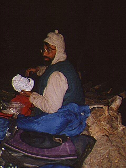
We rested, listened to Rich's jokes and had a leisurely dinner. After much discussion, we decided that four of us, Mike, Nick, Pat and I would make an attempt in the morning. Elmer decided to hike out and Rich said that he would try to reach 11,000 feet later in the morning, but he didn't feel up to a serious summit bid.
The temperature was mild that night and there was virtually no wind. I sat with Elmer by the fire past 10:00, listening to his climbing stories and his insights about relationships, which I found enlightening. I crawled into my bag under the stars and didn't even bother to unroll my bivy bag.
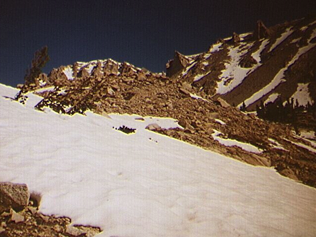
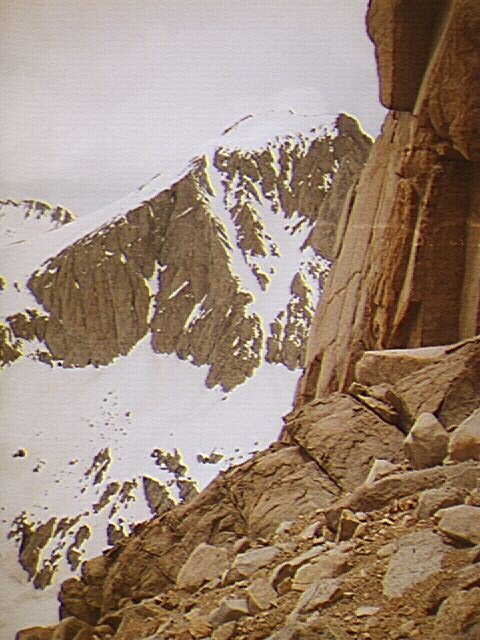
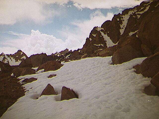
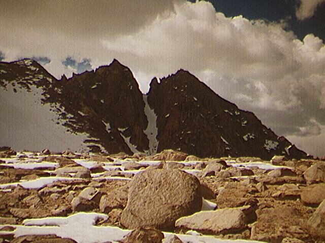
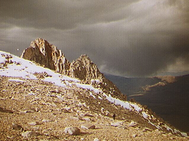
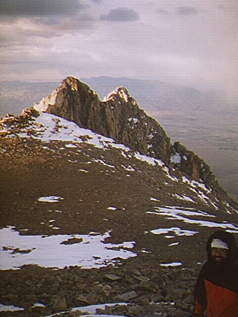
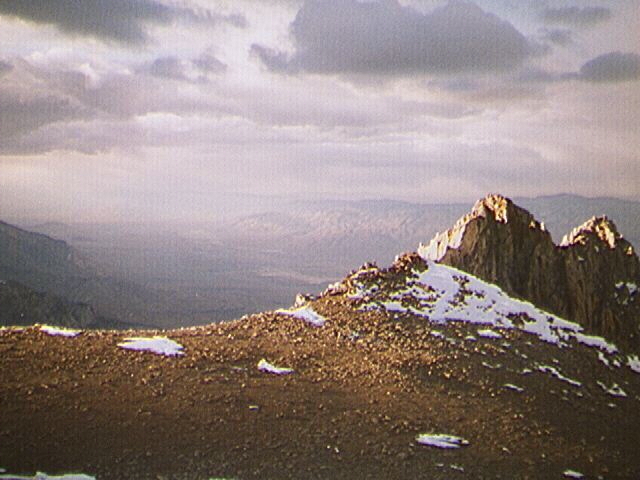
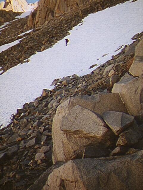
We woke up before five but once again got a late start, about 6:30. After hiking up the slope for 45 minutes, we reached the first snow field and traversed it to the north. We crossed the stream and climbed up next to a waterfall, stopping to fill our bottles. The snow was in good shape, with small cups starting to form. We hiked up the "S" slope. Pat and I made it to a saddle at about 11,300 feet by 10:30. The "A Team", Mike and Nick, had cut to the east a little below us and hiked to the "meadow at 11,200 feet" which Secor describes.
Mike and Nick decided to climb toward a tooth in a wide gully to the right of the route taken by the climbers in my previous trip. After consulting my topo, I decided that their route was fine; less direct but probably easier and it also seemed to follow Secor's recommendation.
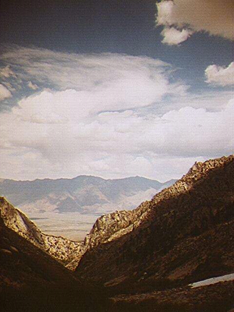
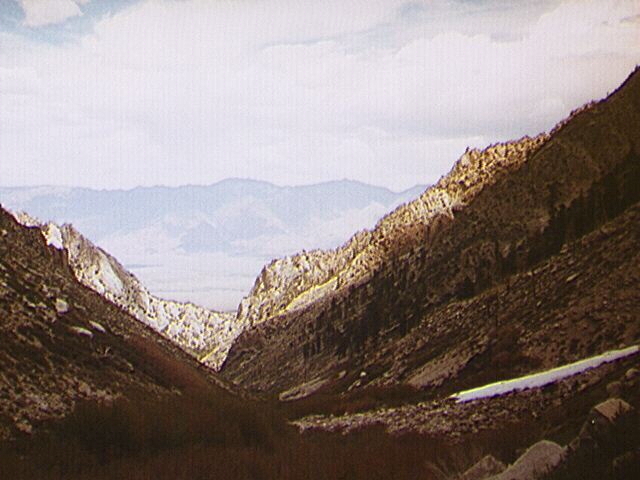
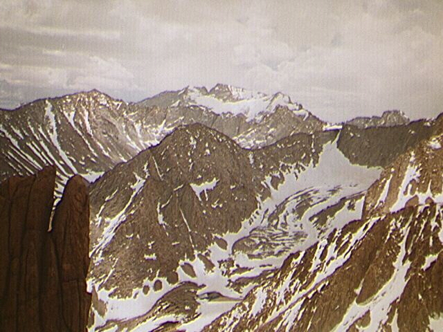
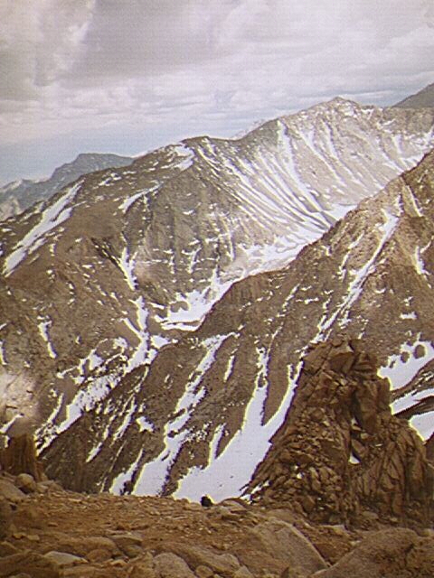
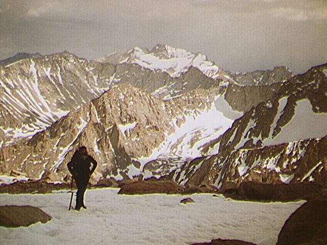
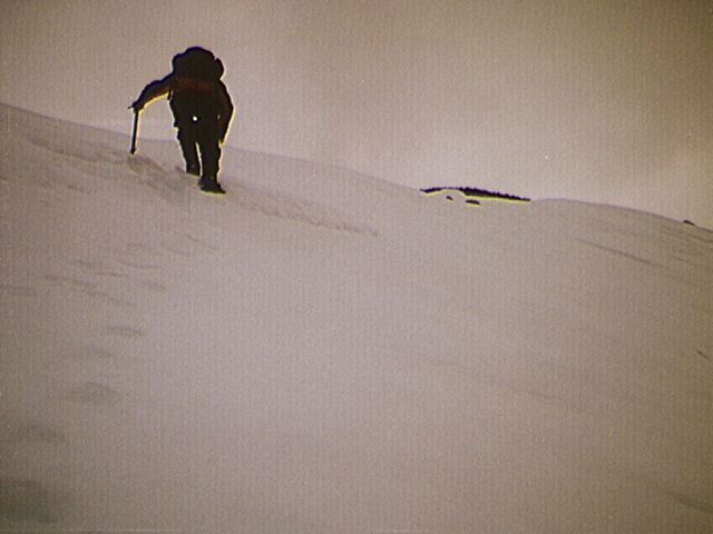
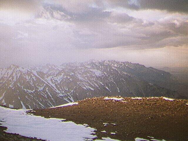
They proceeded up a scree and talus slope onto the first steep snow of the climb. I met Nick descending the snow. He decided to call it quits at that point and he returned to camp after generously letting me borrow his cell phone. Mike came down a little later, complaining that he felt insecure on the snow with his instep crampons. Pat and Mike decided to traverse the wide snow gully and climb a class 2 ridge to the right. I decided to stay on the snow. The higher we got, the better the view. Especially memorable were the views of Whitney and Russell, just a few miles away. The sky was mostly clear but there were some clouds forming over the Inyos and some tremendous clouds on the west side of the Sierras.
After the long slog I met Mike and Pat on the huge shoulder south of the peak that is visible from the highway. Mike decided that it was too late to continue since we still had a long way and nearly 1,500 vertical feet to go. Also, the elevation was starting to bother him. Pat was extremely determined to make the summit. I expressed some doubt about being able to summit and return before dark and I began talking about the possibility of a forced bivouac. I had done plenty of these in the High Sierra but I knew that Pat had not.
When we were high on the shoulder with clear views of the Owens Valley nearly 10,000 feet below our feet, I took out the cell phone. Pat & I called our moms and wished them a happy Mother's Day. This was quite a treat--thanks Nick!
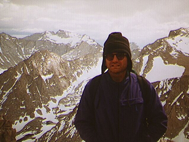
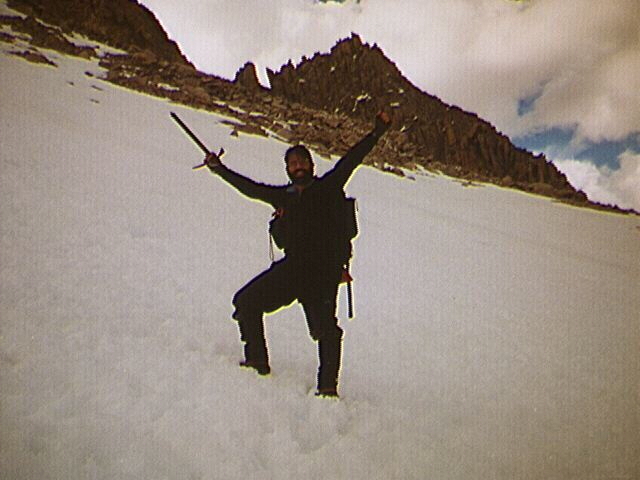
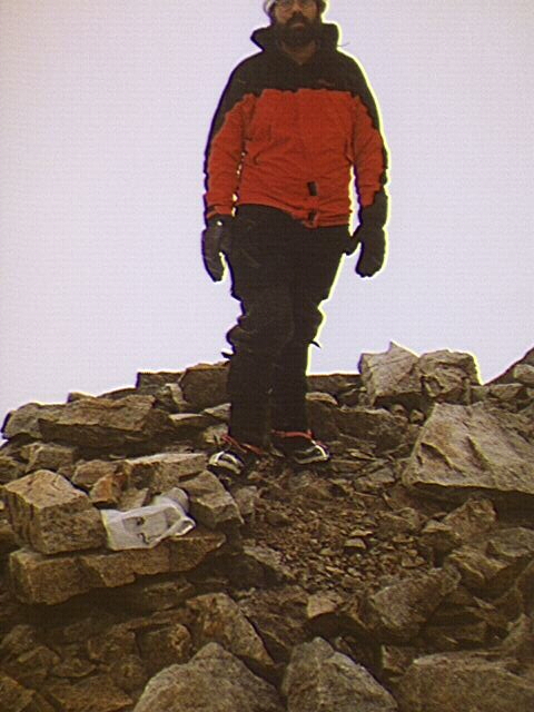
We continued on the long class one shoulder until a large bowl came into view. We did a long snow traverse and hiked up a couple hundred feet of steep snow until we arrived on the summit plateau. It was already past 5 p.m. and a tiny storm was crossing the Owens Valley, heading our way. We quickly crossed the rocky plateau and moved onto a snowy ridge leading to the summit. It began to snow and got windy. By the time we reached the summit, visibility was nil. Pat found the register and wrote an epic poem as I nervously waited my turn. As he wrote, I heard a buzzing about my head, which made me fearful. What would it be like to be hit by lightening here? Would we be instantly killed or slowly freeze to death after being incapacitated by a strike? When I told Mike about the buzzing, he muttered that I was delirious. However a minute later he heard it as well. Finally he finished his entry and I hurriedly scratched my name on the register.
The full force of the storm hit us as we made our descent in a whiteout. Even before we were off the ridge, however, the cloud passed and some blue sky returned. We were now in a race against time to get back to the meadow before dark. From there it would be easy to work our way back to camp with our lanterns.
We glissaded off the plateau. Unfortunately the snow had softened and we didn't make good progress. It got dark after we reached the shoulder. Just before it got too dark to see, Pat sighted the tooth which was the landmark for our descent to the meadow. But Pat announced that he was too exhausted to make a safe descent in the dark.
We found a spot sheltered on three sides by rock. I discovered to my horror that I had forgotten my vapor barrier which was to serve as an emergency shelter. I packed only one tube tent and knew Pat was not carrying a decent emergency shelter. I placed a large garbage bag below us. I emptied my back pack and put my legs into it up to my thighs. I wrapped myself with a practically worthless emergency thermal blanket that Pat carried with him. It was three years old and ripped as I unfolded it. Take my advice and never a blanket. Buy a tube tent instead; the weight is about the same and the tube tent is much more effective. I had a down vest, a Marmot parka with hood and two balaclavas. I had already given Pat my Marmot snow pants prior to our glissade (he was still wearing cotton pants!). I gave him my tube tent. He had no down but he had a thick shirt, a parka and a warm hat.
We ran out of water, but fortunately Pat carried a huge gas stove. Unfortunately he didn't have a pot! So he set rocks on the burner and put snow-filled bottles on top of the rocks. He managed to melt enough snow to relieve our thirst but he burnt a hole in his water bottle. Fortunately I carried three and was able to share one with him.
We were too tired to eat and eventually dozed off. I awoke a while later to rub life into my freezing wet toes. Occasionally we shivered but despite the discomfort we were never in danger of hypothermia. We managed to share a little body warmth by pressing our backs against each other as we tried to sleep. After one of my naps I awoke to find the stars were gone. A few minutes later dry snowflakes fell on us. Fortunately there were not many and they soon dissipated. Pat vomited during the night. He said it was because he had not eaten dinner.
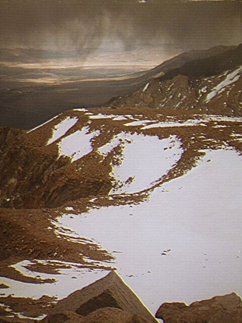
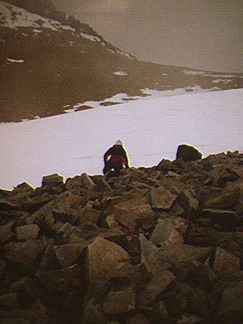
Finally dawn arrived. When I opened my eyes I was treated to an unforgettable mountain scene, with Mt. Whitney and Mt. Russell crowning the magnificent view at my feet. We packed, put on our boots and scrambled down to the tooth. Pat decided to descend as he had ascended -- on the rocks, while I went down the hard snow with my ice ax and crampons. After about an hour or so I reached the meadow and filled up my water bottles from the stream. Pat came down slowly and complained about his blistered feet.
From there we retraced our route back to camp, glissading a few hundred feet. Later we read a note left by Rich. They had seen us glissading at about 9:30 a.m. and satisfied that we were safe, they hiked out. As we approached the camp, I imagined that I saw Nick's tent (it was Pat's) and thought I saw Rich waving to me (it was the big log at our camp). We took a long breather, had a big lunch and packed, confident that we would make it out to the trailhead before dark.
Things went wrong right away. It took us 45 minutes to find the first stream crossing, which was only a few hundred yards from the camp! We missed every other stream crossing and spent much of the afternoon bushwhacking. We spent at least twice the necessary time required to hike out (Study Rich Calliger's hints attached to this report so that this doesn't happen to you!).
Darkness fell when we were about a mile from the trailhead and we were forced to do another bivouac, this one quite comfortable in comparison to that of the previous evening! We were both exhausted and slept very well and stayed warm.
The next day we got up early and had a small breakfast. After more bushwhacking and much route finding, we finally got out about 7:30. We had to hike another hour to reach the road on which Pat left his car. Pat dropped his huge pack (which he had carried all the way to the summit!) and walked to the creek to retrieve the car while I waited on the road. Elmer had gotten us a hotel in Lone Pine where I picked up my stuff and key to my car. We had a huge breakfast and drove off at about 11 a.m.
This was one of my most memorable trips. Every one of the members contributed...Rich and Elmer with their route finding up the drainage...Nick with his cell phone...Mike by leading the first half of the climb. I admire Pat Ibettson, who had never done a big snowy peak before but had the heart to make the climb. I am grateful that he trusted me to guide him up and down the steep snow and to do a safe bivouac. To those who didn't summit: let's try it again now that we know the route. Pat and I can try Trojan while you guys bag Mt. Williamson.
Advice from Rich Calliger on George Creek approach:
Start and remain on the north side of George Creek for less than 15-20 minutes from the trail head and an elevation gain of about 200 feet. Cross over to the south side on any one of several log and boulder crossings. At this point the creek is only 3-4 feet wide during light snow years and easy to cross. Stay there for 99% of the trip up the drainage -- then go to the big boulder on the south side --moderate to climb up and easy to rappel or climb down on the return. (50 feet of 7mm rope is all that is needed to lower packs and do a safety belay).
After that there is one more stream crossing to get around a large cliff face about 3/4 miles upstream from the "boulder". Cross back immediately and remain on the high trail on the south side all the way to approximately 8800 feet. Then cross the stream one more time on the way to the obvious 1/4 mile wide bench at 9300 feet just below the s-shaped avalanche fall starting at 9900 feet. During the first 3 miles up the drainage if there is any doubt as to the location of the trail err on the side of "staying higher just above the brush on the south side" as the route finding algorithm. (It is still one of the more challenging and interesting routes in the Sierra.).
.... this was actually a very easy and doable route with very little bushwhacking... it took us 10 hr. to get up the north side with some gawd-awful bushwhacking but only 4.5 hr. (5.5 total with lunch and breaks) get down after we "found" the south side route.
It was an immensely beautiful area with snow starting at about 9200 feet and melting moderately fast. Full-featured large-medium cupped snow was present starting about 10,200.