In late March 1997, after a long winter break, the lure of mountaineering once again awakened and David Harris and I decided to do start preparing for summer by climbing in the desert. Instead of sloughing up steep snow slopes and postholing our way up frozen, windswept peaks, we wanted to go climbing on a perfect Sierra summer day. Not climbing in gore tex suits with gloves and hats, but climbing in shorts and tee shirts in sunny and warm weather. We returned to an old favorite winter backcountry haunt - Death Valley which is now the largest wilderness area in the lower 48 states at over 3,000,000 acres. We soon came up with several peaks that sounded significant and interesting that neither of us had climbed before; Tin Mountain, Dry Mountain, Corkscrew Peak, and Last Chance Mountain.
After meeting at Mesquite Springs campground at the northern end of the Death Valley the evening before, we struck out at dawn for our first adventure -Tin Mountain. The rough drive up the narrow, rocky Racetrack road quickly ended in a cloud of dust as reached the start of the climb at about 4,800' elevation. The terrain wasn't the usual barren Death Valley scenery but at this elevation was enhanced by numerous Joshua trees, barrel cactus, and assorted cholla cactus. The route across and up the complex of deep cut arroyos was much more complex than we normally experienced climbing in the Sierra. The numerous flash floods had cut the typical alluvial fan into a corrugated maze of arroyos with unstable rock, scree and occasional formidable cactus as hazards.
The route description was less than usually provided by Secor and Roper and the concise DPS route description didn't really help us to find the way. We slowly worked our way up to the only reasonable slope on the peak between the numerous arroyos and cliffs. The west buttress that we were climbing was composed of mostly of crumbling, metamorphic mudstone that when we used it for handholds, broke off into sharp, crumbling chunks. Despite the poor quality of the rock we soon found ourselves at the top of the buttress at about 8,000' elevation in more familiar surroundings with mixed pinion and juniper trees scattered around. A brief climb up through the trees and around a false summit brought us to the top of Tin Mountain in about 3 and half-hours.
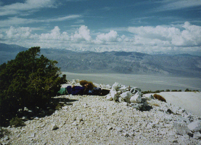
At 8,953' Tin Mountain is the northernmost peak of the Panamint Mountains and offers extensive views of the northern part of Death Valley, across the Last Chance Range and the Inyos, to the southern Sierras from Olancha Peak to the Palisades. After a short break we descended the same route and found it more challenging than the ascent due to the loose sliding rock.
On the second day we had an adventure attempting to climb
Corkscrew Peak.
After a few hours climbing up an interesting deep and sheer walled arroyo we carefully climbed up a steep, broken shale slope to see if we were close to the peak yet. What a surprise we found! The peak was at least a half a mile away across a half dozen deep cut canyons, all with overhanging walls. After a brief bit of concern about being rimrocked, we found a reasonably stable descent back into the canyon that we had ascended. It was the biggest maze that I ever seen. Our lack of experience in this area, the type of terrain, and the lack of either an adequate route description or a detailed topo map was too much for us and we called it a day and returned to camp to plan the next day's climb.
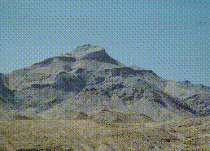
The Last Chance Mountains are the western boundary between Death Valley and Saline and Eureka Valleys. The ride up the rough, washboard road from Mesquite Springs went quickly until we reached the last several miles of rugged four wheel drive road to an abandoned mine site at about 5,000' elevation. We quickly climbed the steep slope above to the tree line and the ridge at about 7,000'.
After numerous up and downs over bumps on the pinion-covered ridge we arrived at
Last Chance Mountain
at 8,456' in about 2 hours.
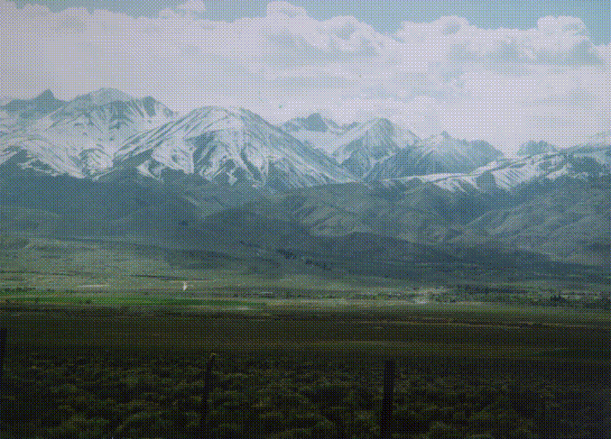
The views to the west were extensive of the Inyo Mountains about 10 miles across Eureka Valley, and beyond to the snow-covered Sierra between Mt. Williamson and the Palisades. To the north loomed White Mountain peak. I've been interested in climbing this peak since I read that Norman Clyde had always wanted to climb it but never had time to get around to it. Having too much fun in the Sierra I guess to drive a few hours from his Big Pine cabin. The descent went quite quickly and easily and we decided to visit the Eureka Dunes for lunch.
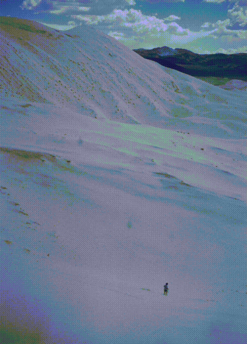
At 800' high these almost white dunes are quite a contrast against the orange and black cliffs of the Last Chance range. After a short climb of the northwest summit of the dunes, we glissaded down the sandy face to our cars and to the end of the trip. To leave Eureka Valley the road climbs westward through a forest of Joshua trees and then into pinion pines before dropping rapidly down the west face of the Inyos into Owens Valley at Big Pine. On the way down into the valley was the most spectacular view I'd ever seen of the Palisades and the Sierra, rising vividly as a white wall against the deep blue sky, over the green fields of one of the few remaining farms in Owens Valley.