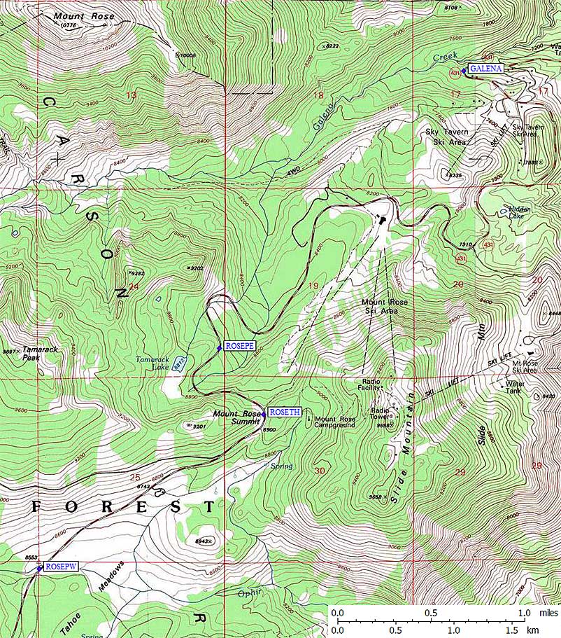
Mt Rose Summit
Revised April 2009 - please send updates to the webmaster
Mt Rose is most often climbed as a day hike in the summer but there is lots of skiing activity in the area during winter. The bowl east of Tamarack Peak (from ROSETH or ROSEPE) is good for snowboarding, while Tahoe Meadows (near ROSEPW) is more of a family sledding and snowshoing area. Note that the HIGHEST trailhead is at the Mt Rose Summit (ROSETH at 8900').
There are biker and hiker trails from Mt Rose Summit (waypoint ROSETH, the high point of the Mt Rose Highway). The eastern and western parking areas marked below appear to be free winter snow-play parking areas. I thought these were official Sno-Parks, but as of 2009 I saw no such signs. There are no facilities at any of these parking areas in the winter, but in summer there are restrooms at the Summit.
Will MollandSimms adds that a much lower trailhead starts from further east, at waypoint GALENA: Go to a big obvious hook in the road close to the Galena creek at about 7500 feet or so. There's nothing marked, just a pullout which is very obvious when coming from Reno, that goes into the trees and then a faint but easily recognizable trail that goes from the creek crossing up towards the ridge. The trail might start at the pullout but it was still snow covered in April.

Useful Links: